 |
| Chicago River, main stem (downtown), looking west |
 |
| Chicago River, looking west from Michigan Avenue (DuSable) bridge |
The past few months I've been working in a museum on the Chicago Riverwalk. The Riverwalk is a partly new addition to downtown Chicago. The city has been chipping away at it since 2001 or so, gradually building a pathway along the main stem of the Chicago River from the mouth at Lake Michigan to (eventually) Lake Street, where the main stem breaks off into two branches, one heading north and one south. As of this summer, the Riverwalk extends as far west as Lasalle Street and has been the focus of a lot of official city fanfare, including an opening weekend of new Riverwalk businesses such as cafes and boat rental docks, free concerts and family day activities, and visits by that Rahm guy.
 |
| The McCormick Bridgehouse & Chicago River Museum and Michigan Ave. bridge |
 |
| Chicago River, at night looking east towards Clark Ave. bridge, with new River Theater at right |
 |
| Wendella water taxi at River Theater stop on the Chicago Riverwalk |
 |
| Kayakers in the river, Marina City towers at left, State St. bridge at right |
The museum I work in is actually a history museum devoted to educating
visitors about the Chicago River and is run by an environmental group
called
Friends of the Chicago River.
Friends of the Chicago River has been working to improve the health of
the river and raise awareness of this often overlooked "other coastline"
of Chicago since 1979. The museum, called the
McCormick Bridgehouse & Chicago River Museum,
is inside an old bridgehouse connected to the Michigan Avenue bridge.
At the museum, we give tours about the history of the Chicago River and
the Michigan Avenue bridge, and we offer visitors a chance to see the
underworkings of the bridge, such as its huge gears, and learn how the
river shaped Chicago and vice versa and why the river has proved to be
such an important factor in Chicago's growth and greatness.
 |
| Ft. Dearborn tour boat passing under State St. bridge, Blackhawks hockey banner in background |
 |
| On the south branch of the river, looking at downtown and Sears Tower |
 |
| Ping Tom Park in Chinatown on the south branch of the Chicago River. See the geese? |
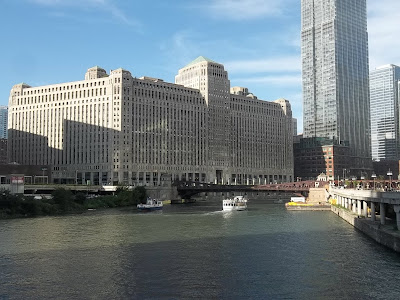 |
| At the confluence. Chicago River where it branches south, with view of Merchandise Mart. |
 |
| View of the river from the Brown Line el train, just after Merchandise Mart stop |
Working at the museum has taught me so much about my home city that I
never even knew or just took for granted. As well as learning more
about the rich and complex history of the Chicago area, I've learned
more about the hidden or forgotten sides of the city, everything from
Chicago infrastructure to the Chicago River's surprisingly diverse and
resilient wildlife (with much thanks to the efforts of Friends of the
Chicago River and its dedicated volunteers). And the best thing is that nearly every day I get to start and end my work day by a walk along this waterway and track its changing moods from month to month, day to day, hour to hour. I've seen the river pummeled with fierce rain, gusted by strong winds, thronged with tour boats and kayakers, peppered with geese and ducks and gulls (and yes, the occasional expired fish), and flooded with sunshine and with rain too. In seasons past I've seen it frosted and frozen. I've seen it dyed green, even though on sunny days it's really already green enough, downtown near the mouth of the river where the lake water comes in. On some sad days I've seen it littered with trash, the work of thoughtless hands and thoughtless minds. I've seen it looking gloomy on overcast days. I've seen it rushing along faster than commuters at the start and end of their work week. I've seen it taking its time, as old rivers are known to do.
 |
| Wake waves. On the south branch. |
 |
| Riverside graffiti, on the south branch. |
 |
| The Chicago River in winter. South branch between Washington and Madison streets. |
 |
| Same section as in pic above, but in the fall. |
 |
| Green, gray, and gold. Below the Franklin St. bridge. |
 |
| Urban kayakers downtown. |
 |
| Yellow water taxi, pink flowers, green wall, red bridge (State Street). |
 |
| Looking east close to the mouth of the river, just before Lake Shore Drive bridge. |
Since I'm working on the river (so to speak) this year, I decided to put up a couple posts related to the river and downtown history this summer. It surprised me when I realized I've never posted specifically about the Chicago River here before (apart from
this post about a disaster on the river 100 years ago and another about the
Clark Street bridge)--though I do have a
few posts already about Chicago's more attention-getting coastline and waterway,
Lake Michigan. What took me so long? The pictures in this post are mostly from the past few months, with a few oldies from the last 6 or 7 years thrown in. They are nearly all pics of the main stem and south branch of the Chicago River. There is far more to the river than what you see here--a whole other branch heading north, as well as dozens of smaller forks and stems all over the city and its suburbs. If you'd like to learn more about the Chicago River and how important a waterway it's been and still is, stop by
the museum sometime or spend an afternoon
canoeing one of the river's quieter avenues or
helping to clean up one of its banks and forests. In the meantime, enjoy the pics.
 |
| Denise Gilmore-McPherson of DGM Photography snapping shots of Ping Tom Park on the south branch. |
 |
| Approaching Amtrak railroad bridge on south branch (Canal St.) |
 |
| Awesome old Amtrak vertical lift railroad bridge on the south branch of the river. |
 |
| The River Theater (between Lasalle and Clark, looking east) downtown at night. |
 |
| Fall sunset on the river, between Clark and Lasalle streets, looking west. |
 |
| Dearborn St. bridge, with Clark St. bridge being raised beyond. |
 |
| The river at Michigan Ave. No, not dyed green here--just mostly lake water at this point (close to the mouth) reflecting sunny blue sky. |
 |
| More green. Plants on the Riverwalk. |
 |
| Kayak near Michigan Ave. |
 |
| Rainbow of kayaks, downtown, main stem. |
 |
| On the banks, at Urban Kayaks. |
 |
| River Theater, with water taxi, Marina City, and Clark St. bridge in background. |
 |
| At the confluence where the river branches north, with Kinzie St. railroad bridge saluting. |
 |
| Bridges, barges, tour boats, and skyscrapers. Busy day downtown on the river. |
 |
| A more relaxing scene, east of Michigan Ave., by Chicago's First Lady docks. |
 |
| Beautiful Chicago. The Michigan Ave. (DuSable) bridge, the Wrigley Building (left) and the Tribune Tower (right), start of the Magnificent Mile. |
 |
| Michigan Ave. (DuSable) bridge, going up. |
 |
| Me (at right) and museum friends Joanne and Corey, on a Wendella river boat, with Chicago flag waving and Lake Shore Drive bridge and mouth of the river in background. |


